
and more.
Seeing More: Hyperspectral vs. Multispectral Imaging
To understand Pixel, you first need to grasp hyperspectral imaging. Think of light as a spectrum, like a rainbow. Traditional multispectral satellites capture images in several broad bands of light (e.g., red, green, blue, near-infrared). This is like looking at the world through a few colored filters.
Hyperspectral imaging, on the other hand, captures images across hundreds of narrow, contiguous spectral bands. This is akin to having a vast library of colour filters, allowing us to see the subtle differences in how light reflects off different materials. Pixel’s satellites are equipped with advanced hyperspectral sensors that can differentiate between materials that look identical to the human eye or even to multispectral sensors.
Practically speaking, this distinction is crucial. A multispectral image might show a patch of land is ‘vegetation’. A hyperspectral image from Pixel can tell you not just that it’s vegetation, but its specific species, its water content, whether it’s stressed by disease or nutrient deficiency, and even identify specific weeds.

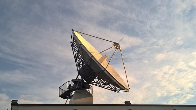
The Pixel Constellation: A Network in Orbit
Pixel’s strategy involves deploying a large constellation of small satellites. This approach offers several advantages over relying on fewer, larger satellites. A constellation allows for more frequent revisits to any given point on Earth, meaning you can get updated imagery more often.
As of June 2026, Pixel has successfully launched several of its hyperspectral satellites, with more planned. These satellites operate in a sun-synchronous orbit, ensuring consistent lighting conditions for imagery collection. Each satellite carries sophisticated hyperspectral payloads designed to capture high-resolution data efficiently.
What this means in practice is that users can receive near real-time or very timely data. For instance, a farmer needs to know about a pest outbreak quickly to prevent crop loss. A constellation like Pixel’s provides the frequency necessary for such rapid detection and response. This contrasts with older satellite systems that might only pass over a location once every few days or weeks.
Transforming Industries: Pixel’s Real-World Impact
The true power of Pixel’s technology lies in its diverse applications. By providing such detailed spectral information, the company is enabling breakthroughs across several key sectors.
Precision Agriculture
In agriculture, Pixel’s data is a major shift for precision farming. Farmers can use the hyperspectral imagery to monitor crop health at a granular level. Identifying nutrient deficiencies, water stress, or the early signs of disease allows for targeted interventions, reducing the need for broad-spectrum application of fertilizers or pesticides.
From a different angle, this technology helps optimize resource allocation. Farmers can pinpoint exactly which parts of a field need attention, leading to more efficient water usage and reduced chemical runoff. According to reports from agricultural tech conferences in early 2026, early adopters have seen yield increases of up to 15% by integrating hyperspectral insights into their management practices.

Mineral Exploration and Mining
For the mining industry, identifying mineral deposits is a costly and time-consuming process. Traditional geological surveys can be slow and expensive. Pixel’s hyperspectral satellites can scan vast areas from orbit, identifying the spectral signatures of specific minerals and rock formations.
This dramatically speeds up the exploration phase. Exploration companies can use this data to prioritize ground surveys, focusing their efforts on areas with the highest probability of containing valuable deposits. It’s estimated that by using such advanced remote sensing, exploration timelines can be cut by 30-50%, significantly reducing costs and time-to-discovery.
Environmental Monitoring and Conservation
Monitoring the health of our planet is becoming increasingly critical. Pixel’s technology offers powerful tools for environmental scientists and conservationists. They can use the data to track deforestation, monitor water quality in lakes and rivers, detect oil spills, and assess the impact of climate change on ecosystems.
For example, identifying specific types of algae blooms or tracking the spread of invasive plant species becomes much more feasible with hyperspectral data. Pivxxx allows for faster, more effective responses to environmental threats. Research published in ‘Environmental Remote Sensing’ in late 2025 highlighted Pixel’s potential in mapping soil carbon sequestration with unprecedented accuracy.
From Raw Data to Actionable Insights
Capturing spectral data is only the first step. The real value lies in processing and analyzing it to derive actionable insights. Pixel is working with various partners and developing its own platforms to help users interpret this complex data.
This often involves sophisticated algorithms and machine learning. AI models are trained to recognize specific spectral patterns associated with different conditions – from the exact chemical composition of a soil sample to the health status of a specific tree. What this means in practice is that users don’t necessarily need to be spectral analysis experts themselves; the platforms can deliver clear, understandable outputs.
From a different angle, Pixel is also focused on democratizing access. By making this advanced data more readily available and affordable, they aim to empower a wider range of users to use hyperspectral insights. This could include smaller environmental consultancies, regional agricultural bodies, or even academic researchers.
Challenges and the Road Ahead for Pixel
While Pixxel‘s technology is revolutionary, there are challenges. Processing and storing the vast amounts of data generated by a hyperspectral constellation require significant infrastructure. Ensuring data accuracy and calibrating sensors consistently across multiple satellites are ongoing technical hurdles.
And, educating potential users about the benefits and applications of hyperspectral data is crucial for widespread adoption. Many industries are accustomed to multispectral imagery and may need time to understand and integrate the richer information provided by hyperspectral sources.
Looking ahead, Pixxel is poised to become a dominant player in Earth observation. Their ongoing satellite launches and partnerships signal a strong commitment to scaling their capabilities. By June 2026, their constellation is expected to be significantly expanded, offering even greater coverage and frequency. The company’s vision is to provide a global, continuous hyperspectral view of the Earth, unlocking new frontiers in scientific research and industrial application.
Last reviewed: June 2026. Information current as of publication; pricing and product details may change.
Frequently Asked Questions
What is pivxxx?
pivxxx is a topic that many people search for. This article provides a thorough overview based on current information and expert analysis available in 2026.
Why does pivxxx matter?
Understanding pivxxx helps you make better decisions. Whether you’re a beginner or have some experience, staying informed on this topic is genuinely useful.
Where can I learn more about pivxxx?
We recommend checking authoritative sources and official websites for the most current information. This article is regularly updated to reflect new developments.
Editorial Note: This article was researched and written by the Novel Tech Services editorial team. We fact-check our content and update it regularly. For questions or corrections, contact us.

